Robotic exploration system expands seafloor map

Research Center for Undersea Observation and Implementation Engineering, Institute of Industrial Science, The University of Tokyo
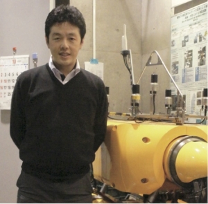
Toshihiro Maki Associate Professor
The goal is to locate resources that exist somewhere on the vast seafloor, and then create a detailed seafloor map of the surrounding area to determine the location of the collection equipment. Although this can be expressed in words, it is not easy to realize with current technology. Associate Professor Toshihiro Maki of the University of Tokyo's Institute of Industrial Science is developing a system that can autonomously map the topography of the seafloor. In the near future, unmanned probes may be cruising the seafloor, just like a robot vacuum cleaner moving around the house cleaning.
10 million yen/day to eliminate the need for costs.
Today, researchers who investigate the seafloor frequently travel by observation vessel. When examining the crust beyond the thick layer of seawater, they use methods such as ultrasonic and imaging observation by remotely operated vehicles (ROVs) and battery-powered autonomous unmanned vehicles (AUVs) that are wired to the ship, requiring a large observation vessel as a control center and power supply base to handle them. A large observation ship is needed as a control center and power supply base to handle these methods. In addition, in order to determine the location of the observation site on the earth, it is necessary to use the ship's onboard GPS as a reference for surveying. A survey by a large observation ship costs 10 million yen per day. Developing technology to reduce this cost should accelerate the progress of seafloor exploration, according to Maki. Under development is an autonomous seafloor mapping system that links multiple AUVs and underwater stations.
Developing the entire system on our own
The main points of this system are as follows: The AUV should be able to make detailed observations of the seafloor topography and record its own position (relative to the underwater station) at the time of the observation. The underwater station should be able to know the coordinate position on the map, extract data from the AUV, and supply power to the AUV. These features will enable the AUVs to automatically survey and map the topography around the station once the system is installed underwater. Mr. Maki, whose background is in systems engineering, is responsible for all of the various technological development elements.
For example, in addition to direct observation by photography, detailed observation by AUV uses the optical cutting method, in which a laser beam is projected onto an object and the reflected light is captured by a camera located at a distance from the light source for triangular ranging. The circuit design and data processing for this method are all done by the company's own technology. The station and the undersea station also record the location of the observation points using acoustic positioning, which estimates the relative position based on the azimuth and distance between the two. Since the station is fixed to the seafloor, it is possible to determine the location of the AUV on the map by aligning its coordinates with those of the station. In addition, the station has already been tested in a water tank for non-contact power supply from the station to the AUV using the electromagnetic resonance coupling method, and fully automated docking, including recharging, has been realized.
Advancing Autonomy and Expanding Exploration
Maki says that the company plans to conduct a demonstration test in the ocean in the near future. Unlike in a tank, there are waves and tides in the ocean, which reduce docking accuracy. Therefore, we will need a method to maintain power supply efficiency even when positional accuracy is low. We would also like to connect submarine cable networks to undersea stations to enable power supply and data transfer without the need for vessels," he says. While these developments are bringing mapping of coastal areas and areas around submarine cable networks closer to reality, there is a further idea. One idea is to use an AUV, which can also land on the bottom, to autonomously expand its observation range using only a robot. While the basic movement is the same as described above, one of the two AUVs lands on the bottom to form a station, and the other uses it as a positioning reference to search the surrounding area. Once the search distance has been covered, the AUVs will land at the destination and become a station, and the AUV that was previously acting as a station will switch to the role of explorer. There are some issues to be addressed, such as how to supply the energy needed to operate the AUV, but the company has already conducted experiments using hydrothermal vents to generate electricity from heat. Expectations for the future of seafloor resource exploration are high as one thinks about the future of seafloor resource exploration. First, observation vessels will be sent to areas where resources are located to conduct sonar, gravity sensing, electromagnetic observation, and ground sampling. If they find it promising, they drop multiple AUVs into the ocean and the vessel returns. When they go to the same location a few months later and retrieve the AUVs, a detailed topographic map of the surrounding area has been completed, showing the best drilling points. ...... If such a future were realized, the value of resources on Earth would change dramatically.

